Nationwide GPS Coverage: What It Means for a Family Tracker
GPS works across the U.S., but a tracker also needs a network to report. Here is what nationwide coverage really means for kids, pets and parents.
Nationwide GPS Coverage: What It Means for a Family Tracker
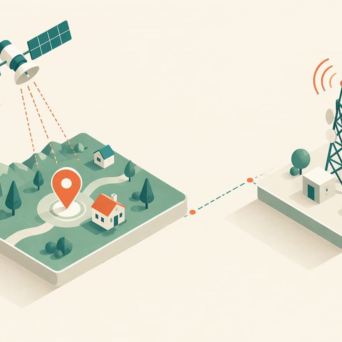
GPS itself covers the entire United States and the rest of the planet. What varies from place to place is the second half of the job: getting the position your tracker calculates onto your phone. When someone says “nationwide coverage” for a family tracker, they are really talking about two layers, satellites in the sky and a network on the ground. This guide explains both, shows where gaps appear, and tells you what to check before you rely on a device for your kids, your dog or a parent.
Kinwatchdog
One Map for Your Family
Kin One shows the locations of kids, pets and parents on one map, with real-time updates and no monthly fees.
TL;DR
- Civilian GPS is continuous and worldwide, so no U.S. state lacks satellite coverage.
- Satellites only broadcast signals. A tracker needs a network connection to send its position to your phone, and that is where rural gaps show up.
- Official coverage maps are models of outdoor, stationary service. Real results change with buildings, terrain and the device.
- Kin One is a one-time $99 purchase with no monthly fees, built to show kids, pets and parents on one map.
- Before you buy any tracker, check how it behaves when it has a GPS fix but no network, and where your family actually spends time.
Table of Contents
- What “nationwide GPS coverage” actually means
- Layer one: the satellites cover every state
- Layer two: the network that carries the location to you
- Why a tracker can miss a location even with full coverage
- When the tracker knows where it is but cannot tell you
- A practical coverage check before you buy
- Coverage by person: what to think about for each
- Our perspective on nationwide coverage
- Choosing a tracker with coverage in mind
- Kin One for families who want one map
- FAQ
- Sources
What “nationwide GPS coverage” actually means
The phrase mixes up two separate systems.
The first is GPS, the satellite constellation. According to GPS.gov, satellites transmit one-way signals carrying their position and the time, and a receiver uses those signals to work out its own position and time. The satellites do not follow anyone around. GPS.gov is explicit that they are beacons, not trackers: they broadcast and never listen.
The second is the reporting path. A “GPS tracker” is a receiver bolted to a radio. The receiver figures out where it is. The radio carries that answer to a server, and the server hands it to the app on your phone. If the radio cannot reach a network, the receiver may still know where it is, but you will not see it.
So a tracker has “nationwide coverage” only to the extent that both layers work where you need them. The first layer is effectively guaranteed. The second is the one worth reading about.
Layer one: the satellites cover every state
GPS.gov says the baseline constellation is designed so that users can see at least four satellites from virtually any point on Earth, and that the Space Force normally operates more than 24 of them. The U.S. Coast Guard Navigation Center adds that GPS supports land, sea and air users anywhere in the world, around the clock and in all weather, with one condition: the receiver must be able to process signals from satellites in view.
That condition is the practical catch. “In view” means the receiver has a reasonably open path to the sky. A hiker on a ridge in Montana and a kid on a playground in Phoenix both qualify. A kid in a basement does not, and neither does a dog in a deep ravine.
There is no such thing as a state where GPS is weaker because of national boundaries. If your tracker fails to report in Nebraska or Maine, the cause is almost never the satellites.
Layer two: the network that carries the location to you
This is where “nationwide” gets complicated. A tracker that reports over a mobile network is only as reachable as that network is at the spot where the device happens to be.
The FCC publishes a national mobile map, and it is the best public starting point. It shows 4G LTE coverage modeled at a minimum 5 Mbps download and 1 Mbps upload, and it has separate layers for broadband and for voice. The agency notes that areas showing only voice coverage may not have data service at that speed. That matters for trackers because a location report is a data message, not a phone call.
There is a second, more important caveat. The FCC explains that its mobile map is based on propagation modeling and depicts expected service outdoors and while stationary, not indoors or in a moving vehicle, and that actual experience can vary. The Broadband Data Collection help center repeats the point: mobile coverage areas are models, they exclude indoor availability, and they can differ from carrier maps because of assumptions such as roaming.
The FCC has also warned in an earlier competition report that provider-reported coverage may not exist everywhere within a census block and that the figures can overstate the service available to a particular person or household. Read a coverage map as a good first guess, never as a promise about your child’s school, your parents’ street or your dog’s favorite trail.
Rural areas, farms and trails
Cities and highways are the easiest places for a network-based tracker. The thinner the population, the more likely you are to find pockets with weak or no service, such as river valleys, canyons, national forest roads and the backs of large properties. If your family hunts, hikes, ranches or camps, check the FCC map for those specific places, then treat the result as an optimistic estimate.
For trips where you expect to be well outside any network, a different class of device exists: tools that talk to satellites for messaging rather than to towers. We compare the two approaches in our satellite messenger vs GPS tracker guide so you can choose by situation, not by label.
Why a tracker can miss a location even with full coverage
Coverage is not the only reason a dot goes missing. GPS.gov lists several things that degrade or block positioning: satellite blockage, indoor or underground use, reflected signals, interference or jamming, solar storms, satellite maintenance and poor device design. Buildings, bridges and trees are the everyday culprits.
GPS.gov also gives a useful benchmark: a smartphone is typically accurate to within a 4.9-meter (16-foot) radius under open sky, and accuracy worsens near buildings, bridges and trees. Families sometimes expect a pinpoint on a doorstep. A better expectation is a small circle that is tight outdoors and looser around tall structures.
A few real-life examples show how this plays out:
- School. A child inside a large brick building may show up at the building’s edge, or show the last outdoor position, until they step outside.
- Parking garage. A parent’s position may freeze at the garage entrance. The tracker is not broken; the sky is blocked.
- Backyard. A dog in the open yard will usually report cleanly. A dog in a metal shed may not.
- Downtown. Tall buildings reflect signals, so the dot can jump a block. Moving to open sky usually settles it.
We go deeper on this in how accurate GPS trackers are, outdoors versus indoors and in our guide to GPS tracker accuracy for U.S. families.
When the tracker knows where it is but cannot tell you
The most useful distinction in tracker troubleshooting is between positioning (the device found itself) and reporting (the device delivered that fix). Many “it’s not working” moments are reporting problems: the receiver has a fix, but the radio has no network at that moment.
What a tracker does next depends on how it is designed. Some keep the last known location on your map. Some hold recent positions and send them when the connection returns. The details differ by product, so read the manufacturer’s description of offline behavior before you buy. For a plain-language walk-through of the general pattern, see our article on what happens when a GPS tracker loses signal, and our troubleshooting guide that separates positioning and reporting.
Caregivers tracking older relatives meet the same situation with wearables, where a device may have a position but no way to send it. A resource on trackers for independent seniors covers how devices behave when a GPS position exists but the cellular update does not go through, which helps you set sensible expectations for a parent who walks daily.
How often does a tracker update?
Update frequency is a setting or a design choice, and it varies widely between products. Some devices report every few seconds while moving, others every few minutes to save battery. Faster reporting uses more power. When you compare devices, look for three things on the product page: how often it reports during movement, how often when stationary, and what the battery life is at that rate. If a page gives only “real-time” with no numbers, ask what that means in practice.
Kin One is designed to give real-time updates and arrival and departure alerts, so you can see when a child gets to school or a dog leaves the yard without watching the map all day.
A practical coverage check before you buy
You can answer most coverage questions in about fifteen minutes. Here is the routine we suggest.
- List the places that matter. Home, school, grandparents’ street, the dog park, the lake house, the route between them. Ten places is plenty.
- Open the FCC mobile map and look at each one. Switch between the broadband and voice layers. Note any place where only voice is shown, since data is what a tracker needs.
- Mark the weak spots. Anywhere that shows no coverage, or that you know has dead zones from your own phone, is a place where updates may arrive late.
- Think indoors. The maps model outdoor service. If your child spends hours in a basement gym or a metal-roofed barn, expect looser results there.
- Decide who carries it and how. A tracker in a backpack’s outer pocket sees more sky than one buried in a bag. A collar-mounted device sees more than one in a pocket of a coat hung in a closet.
- Learn the offline behavior of the device you are considering and decide whether you are comfortable with it for each person or pet.
If you want a broader setup routine, our family safety checklist covers eight steps for kids, pets and caregivers, and the five checks for emergency location sharing cover the situations where you most need the location to be right.
Coverage by person: what to think about for each
Different family members live in different places, so coverage matters differently for each.
Kids. Most of a child’s day happens in a handful of spots with solid service: home, school, practice fields. The gaps tend to come on field trips, camping weekends and rural grandparents. If your child does not carry a phone, a standalone device is the route, and we explain it in GPS trackers for kids without a phone. Our pages on GPS trackers for kids and for teens cover how families use location sharing at each age.
Pets. Dogs roam through woods, fields and neighborhoods, so tree cover and terrain matter more than for a kid at school. See GPS trackers for dogs and pets, and GPS tracker for cats if yours goes outdoors. A Bluetooth-only item tag works differently from a network-connected tracker, and the distinction is laid out in our GPS tracker vs AirTag comparison.
Parents and seniors. Older adults who walk, drive or garden alone are often in places that have decent service, but a position that stalls inside a store or a garage can alarm a family needlessly. Setting expectations ahead of time makes a difference. More on this at GPS trackers for seniors.
Our perspective on nationwide coverage
Families ask us whether a tracker works “everywhere.” The honest, useful answer is that the sky part is solved and the ground part depends on where your people actually are.
That is why we built Kin One around a simple idea: one device, one map, and one payment. You pay $99 once. There is no monthly fee and network data is included for life, so you never face a bill that makes you wonder whether coverage is worth keeping. Subscriptions turn a safety tool into a recurring decision. We would rather you keep the device charged and in the backpack.
We also kept the feature list focused. Kin One does real-time location, arrival and departure alerts, up to five approved emergency contacts, and privacy controls including route deletion and user-managed visibility. It does not listen through a microphone and has no camera. Location, shared with the people who should have it, is the whole job.
Our advice is to check your own map, know your own routine, and choose a device whose behavior you understand. A tracker you understand is one you will actually trust.
Louis
Choosing a tracker with coverage in mind
When you compare devices, use criteria that connect to the two layers described above.
What to checkWhy it matters for coverage
How the device reports its location
Network-based trackers depend on service where the person or pet goes. Bluetooth-only tags depend on nearby phones.
Ongoing fees
A required plan can lapse and leave a device silent. A one-time price removes that risk.
Update behavior
Frequency when moving and when still, and how battery life changes with it.
Offline behavior
Whether it keeps the last known location and what it does when the network returns.
Alerts
Arrival and departure notices tell you what happened without constant map checking.
Privacy controls
Who can see locations, and whether history can be deleted.
Warranty
Coverage if the hardware fails. Kin One includes a two-year warranty.
Our page on a GPS tracker with no monthly fee explains what to look for on the pricing side, and the guide to tamper-resistant family GPS trackers covers what to test for a device a child might try to leave behind.
Kin One for families who want one map
If you are ready to put kids, pets and parents on a single map without a subscription, Kin One is built for that. It is a one-time $99 purchase that includes lifetime network data, real-time updates, arrival and departure alerts, up to five approved emergency contacts and a two-year warranty.
You can read the details on the Kin One product page, or see how the pieces fit together on the family GPS tracker page. If your main question is how Kin One compares with screen-time tools that live on a phone, our Family Link vs GPS tracker page lays out the difference.
FAQ
Does GPS work all over the United States?
Yes. GPS.gov describes civilian GPS as continuous and worldwide, so every state has satellite coverage. The receiver still needs a reasonably clear view of the sky, which is why indoor, underground and heavily wooded places can be a problem.
Can a GPS tracker work in rural areas?
The tracker can calculate its position anywhere with sky view, but sending that position to your phone needs a network connection. In remote areas that connection may be patchy. Check the FCC’s mobile map for the places you care about, and remember it models outdoor, stationary service only.
Is there a GPS tracker with no monthly fee?
Yes. Kin One costs $99 one time, with lifetime network data and no monthly subscription. You can see what else to check on pricing in our no-monthly-fee guide.
Why does my tracker show an old location?
Usually the device has lost either its sky view or its network connection. Indoors, in garages and in dead zones, the map may hold the last reported position until the device reconnects. Moving to an open area typically restores updates. Our troubleshooting guide walks through each case.
Sources
- GPS | GPS.gov
- FAQ | GPS.gov
- Space Segment | GPS.gov
- GPS Accuracy | GPS.gov
- GPS Accuracy causes of error | GPS.gov
- GPS Frequently Asked Questions | U.S. Coast Guard Navigation Center
- Mobile LTE Coverage Map | Federal Communications Commission
- What’s on the National Broadband Map | FCC BDC Help Center
- 17th Annual Mobile Wireless Competition Report | Federal Communications Commission
- Best Fitness Trackers for Independent Seniors